
Eight years after the hiker’s disappearance, still no answers…or are there? We take a deep dive into a few possible theories.
Note from Adam: On Thursday, May 3, 2018 human remains were found near the Stubbe Springs Loop Trail in Joshua Tree National Park, not far from where Bill Ewasko, the subject of this article, disappeared in 2010. At the time of posting this blog the remains, described as “a skeleton”, have not been officially identified. Through Facebook posts it has been apparently unofficially confirmed to be a different hiker who went missing in the area in 2016.
*********
William “Bill” Ewasko was a 65 year-old hiker from Georgia who traveled to California in June 2010 to go hiking in Joshua Tree National Park. On his first day there, June 24, he went missing and has not been seen since.
I’ve been involved, peripherally, in a crowdsourced DIY search effort spearheaded by engineer Tom Mahood (whose account of his successful effort to solve the mystery of the Death Valley Germans riveted me and attracted me to this project). Tom’s website otherhand.org contains extensive write-ups (some mine) of all the searches for Ewasko along with other information about the mysterious case.
After having made 20 trips to Joshua Tree, the last of which was with a New York Times reporter who recently wrote about Ewasko’s disappearance, I’ve developed my own theories and ideas about Ewasko’s disappearance. Since the last time I wrote about them (here, here, and here) was just prior to forming my working theory about what happened, I thought launching this blog with a section about unsolved mysteries would be a great opportunity to talk in depth about the mystery and put forth what I think are the two or three most likely scenarios of what happened to Mr. Ewasko.
The Backstory

William Michael Ewasko (hereinafter “Bill” – not meaning any disrespect but to those of us who have searched for him he’s always been “Bill”) was an ex-CFO of several companies, as of 2010 employed at a financial firm, from Marietta, Georgia. An avid hiker, he made frequent trips to Joshua Tree National Park (“JTNP”).
Bill flew to LAX on Wednesday, June 23, 2010 for what would be his last trip to Joshua Tree. He spent the night at a friend’s vacant condominium before driving to Joshua Tree on the following day, June 24. According to his then-fiancée Mary Winston, Bill planned to spend a week in the area and fly home on July 1, with a further trip to Florida planned on his return.
On his way to the park the morning of June 24, Bill made two phone calls, reporting that he was on Interstate 10 near Palm Desert, a location subsequently verified by cell phone records. The first call was to the owner of Bill’s condo. On the second of these phone calls Bill called Ms. Winston and according to her may have given the impression, but did not actually state, that he might go to Carey’s Castle, an old miner’s dugout in a remote and unpublicized corner of the park. Ms. Winston reports that he was in high spirits that morning, and though she was concerned about the danger of visiting such an isolated location and tried to dissuade him, Bill did not indicate any change of plans – only that he planned to be out of the park by 5 to get dinner at Pappy & Harriet’s (a restaurant-nightclub well known to many of my musician friends) in nearby Pioneertown, and that he would call Mary when he was out of the park.
That call never came. According to the recent New York Times Magazine article about Bill, Mary then tried his cell multiple times, but the calls went directly to voice mail. Because JTNP was closed for the day, she was not able to alert them until the following morning shortly before 8 a.m. Acting on Mary’s tip, rangers immediately proceeded to Carey’s Castle but there was no sign that anybody had been there for some time.
Bill had left an itinerary with Mary for his trip which included several spots in the general vicinity. Significantly, the other Joshua Tree locations – prospective alternates if Bill decided against Carey’s Castle – were Lost Horse Mine and Quail Mountain, along with Johnny Lang Canyon, Crown Prince Lookout and Lucky Boy Vista. All of these locations would put Bill in the same general area in the upper-middle section of JTNP, but with multiple places he might have parked his rental car. Park rangers had little else to go on.
For the next day and a half, park personnel fanned out all over JTNP looking for Bill’s car. On Saturday afternoon a sheriff’s deputy was dispatched to Bill’s borrowed condo where several additional itineraries and numerous maps were found. One of the itineraries had listed for that Thursday “Thousand Palms, Joshua Tree all day, Lost Horse Mountain” which added little to the information already at hand. Fortunately, only a few hours later, a California Highway Patrol helicopter at last spotted Bill’s rental car, at a place called Juniper Flats Trailhead. The search could now begin.
The Search
Just before 7 p.m., having received confirmation from the helicopter pilot that the license plate matched Ewasko’s, JTNP ranger Jimmy Pritchett was first to arrive at the scene. He found no evidence other than a list of directions from the west entrance of the park to Juniper Flats on the passenger side and a set of footprints that looked fresh.
After being joined by another ranger and the CHP helicopter, Pritchett drove up Juniper Flats Road, an old jeep trail now closed to the public but often used by hikers heading for Quail Mountain, calling to Ewasko via a loudspeaker. Not getting a response, Pritchett returned to the lot where he was soon joined by police from the neighboring county and volunteer searchers. Pritchett dropped off two teams of searchers to cover the California Riding and Hiking Trail, which runs roughly parallel to Juniper Flats Road and recrosses it near Juniper Flat, and Stubbe Springs Trail, a side loop trail. They were only able to cover part of the area before night fell. Upon their return several of the searchers pointed towards a nearby ridge and said that they could see lights. Pritchett looked but could not confirm this.
A ranger was left at the car through the night, and in the morning with Bill having failed to show up, a proper search got underway using park personnel and volunteer search and rescue at about 7:30 a.m. that morning, fanning out in the most likely areas in the vicinity of Bill’s car. The ridge line where lights had been seen the previous night was searched, but nothing was found. Later that morning, however, searchers recovered a red bandana on the ridge near Quail Mountain. It would be the only possible sign of Ewasko found in the entire search.
On Monday the effort continued, with Riverside County Sheriff’s Department now an active partner in the search. Besides hiking parties, searchers on horseback, helicopters and canines were now employed. The tracking dog indicated Ewasko may have taken the California Riding and Hiking Trail up to the point where it intersects with Juniper Flats Road where the latter heads toward Quail Mountain, but apparently was able to track no further. Since this is a junction of all trails in the area, it offered no guidance as to where Bill might have gone next.
That evening, sheriff’s detectives were given the one confounding clue that thereafter would perplex everyone that would look into the Ewasko’s disappearance. It was revealed that the previous (Sunday) morning, at about 6:30 a.m., Ewasko’s phone had pinged a cell tower in Yucca Valley, a city about 20 miles northwest of where his car was found. This raised hopes that Ewasko was still alive and mobile, and JTNP rangers requisitioned a night helicopter with thermal imaging capability to search the areas Ewasko might be found. He was told this would be done, but it was not.
On Tuesday another potential clue was found – two water bottles that were hidden under a log in the search area. A scent dog indicated a high probability that both the bottles and the bandana were handled by Ewasko – except another hiker would come forward later to claim the bottles as his own, casting the scent dog’s reaction to the bandana in doubt as well.
The official search continued until July 4th, covering ever-increasing ground, before it was called off to be continued by the park service “on an intermittent basis.” Searchers did report unusual smells or even the “stench of death” in various places, but none of these led to Bill’s remains being found. Some of these were attributed to animal carcasses found in the vicinity. By this time, investigators had been able to piece together more eyewitness information about Bill’s car – but the reports were so irreconcilable with one another investigators chose to disregard them entirely. That’s understandable since eyewitness reports are often unreliable, and because in this case, if they are all true, they paint a bizarre and inexplicable scenario.
Where Was Ewasko’s Car?
There’s no question that the search for Ewasko was severely hampered by Bill not being at the location he was expected to be (Carey’s Castle) and his car not being found for more than two days. Yet the place his car was found – Juniper Flats Trailhead – was consistent with the area his itineraries suggested he might be going as a second option. It’s the closest trailhead to Quail Mountain (with Smith Water Canyon and Johnny Lang Canyon lying beyond), and Lost Horse Mountain is nearby with the entrance to its parking area on the opposite side of the road. So why wasn’t the car located earlier?
There are two possible answers: shocking incompetence by a JTNP ranger, or the car simply wasn’t there to be seen.
To understand this, let’s look at the timeline, as best we know it, from the morning of Bill’s disappearance up until the time his car was found.
After his last few calls Thursday morning while driving down Interstate 10, Bill’s phone would not be heard from again except for that brief ping nearly 3 days after his disappearance – a mystery in itself which we will delve into shortly. What happened next is mostly unknown, but almost all of what we do know is puzzling.
Aside from Bill, there was only one known visitor to Juniper Flats Trailhead on Thursday, a hiker named Greg Mendoza – a person, according to the JTNP report at the time, already known to one of the ranger staff. At the time of Mendoza’s arrival, approximately 10:20 a.m., there was no one else at the trailhead, however upon his return between 5:30 and 6:00 p.m., he encountered Ewasko’s car parked parallel and next to the curb on the north side of the parking area (instead of in one of the diagonally drawn designated parking spots – this seemingly minor detail will shortly take on more importance). He also saw a single line of fresh boot tracks going up the old Juniper Flats road.
Mendoza’s sighting means Bill’s car arrived at the parking lot no earlier than 10:20 a.m., leaving, at minimum, a nearly 2 ½ hour gap from his last phone call. It should have only taken Bill about half that time to reach Juniper Flats trailhead. It’s unknown where Bill was for the extra hour or so. There are two more wrinkles though; it is believed that Bill had no more than five, and possibly as few as two, 12 ounce bottles of water with him when he started his fateful hike*. It’s hard enough to believe that he managed to survive for nearly three days on so little water in the height of a California desert summer – if he went on another hike before hand it becomes even harder to believe (though not at all impossible as we will shortly see). And odder still, the entrance to the park did not record Bill’s senior pass going through the gate, though it is theorized that he may have been simply waved through if there was a long line of cars when he entered the park.
*The question of how many water bottles Bill had with him is confusing. Initially the investigating detective indicated he had three “Safeway” bottles with him apparently based on a receipt found in the car. Later it was discovered that Bill had bought a crate of water bottles at a Safeway the previous night, of which all but two bottles were later found either in Bill’s car or back at the condo. However, if detectives did actually find a receipt for three water bottles that must have been from a different Safeway run than where the crate was bought, meaning it’s possible that he had as many as five water bottles with him, which would make his survival through Sunday morning easier to understand. On the other hand, given all the bottles were from Safeway, and Bill was only in southern California for about a day, it may just be a mistake. We simply do not know, but between 2 and 5 12 ounce bottles of water is a safe assumption.
The car was sighted again the following (Friday) morning at approximately 8:45 a.m. by David and Cheryl Haber, a couple en route to a hike on Ryan Mountain. They too observed in an email to the JTNP rangers the car was “parked parallel to the long curb that you head in at,” further stating “it was passenger side to the curb, maybe a couple feet from the curb.” When they arrived back at the parking lot, shortly before 10:30 a.m., they reported that there was another car parked head in on the other side of Ewasko’s car, “about 20 feet from the front of it.”
By this time, the official search was underway for Ewasko’s car. According to the official log, at 1:30 p.m. Friday JTNP park ranger Mike Grayson was dispatched “to check the Lost Horse Mine and Keys’ View”, two trailheads nearby to and off the same road as Juniper Flats trailhead. To get to both of these Grayson had to drive by the Juniper Flats parking lot which was in clear view of the road. Did Grayson get tunnel vision and not check Juniper Flats along with the other trailheads because he wasn’t explicitly told to? Did he not see the white car as he was driving by (twice, coming and going, since it’s a dead end road) against the backdrop of a bright summer desert day? We don’t know. We do know that he reported back that Bill’s car, which according to the Habers was there three hours before, was not in the area.
By 9 a.m. the next morning (Saturday), with Bill’s car still not found, Grayson was sent back to the area again to double-check. Grayson repeats his rounds and again repeats his negative result, except this time, he explicitly says there are no vehicles at the Juniper Flats trailhead.
About 45 minutes later, JTNP employee Mimi Gorman drives down the same road, en route to nearby Keys View where she is about to give a presentation. Focused on remembering the facts that she has to master in a few minutes, Juniper Flats trailhead does not draw her notice as she drives by. Four hours later, finished with the presentation and now hungry for lunch, Ms. Gorman drives back with an eye to an impromptu picnic at the usually-uninhabited parking lot….except now there is a “newish” white vehicle parked there and, wanting privacy, she drives on. Ewasko’s vehicle, twice (or four times, depending on how you count) missed by Grayson, has “reappeared” – but with a further improbable twist.
When Ms. Gorman told her story to Ranger Pritchett the following week, Pritchett was surprised to hear her describe Ewasko’s vehicle as “the only vehicle there, and it was backed in and away from the curb, at an angle” rather than parallel to the curb as it was found later and as the two hiking parties had seen it on Thursday evening and Friday morning. Adding to Ms. Gorman’s credibility, she added that she remembered seeing something “yellow, orange or red” on the front of the vehicle. Ewasko had in fact left a yellow parking pass on the dashboard of the car. Would Gorman have even been able to see that if the car had not been parked facing the road? Pritchett decided to show her a photo of how the car had been found. Ms. Gorman immediately exclaimed “that’s not how it was parked,” further confirming that the car in the photo appeared to be the same one she had seen, and that no other cars had been in the lot.
Less than four hours later, Ewasko’s car would be found, once again parked parallel to the curb, near and facing the trailhead, as it had been observed Thursday and Friday morning. Eyewitness reports are notoriously unreliable, and as far as is known the JTNP rangers and Riverside County Sheriff’s deputies did not pursue the matter any further. There is one further subtle discrepancy that has gone unobserved until now, however: In the Habers’ email to the JTNP rangers, they described Ewasko’s car as being “passenger side to the curb, maybe a couple of feet from the curb.” Yet photos of Ewasko’s car after its discovery on Saturday afternoon clearly show it parked flush to the curb with only a few inches’ clearance from the tire to the edge.
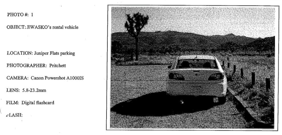 Photo of Bill Ewasko’s car as it was found, from the original JTNP ranger’s report (courtesy Tom Mahood/otherhand.org). Note that it is parked close to the curb.
Five people were known to have been at (or drove by) Juniper Flat during the time Bill was missing. Only one person’s description aligns exactly with how the car was found. Is this another example of eyewitness unreliability – or did Bill’s car disappear for a day, reappear parked incorrectly, then still later reparked approximate to how it was left on Thursday? It’s understandable that of the two possibilities, authorities decided the first was less improbable. Is there another scenario that could reconcile the different accounts? Possibly, as we will shortly see.
The Ping
With the exception of the bandana, lights and various bad smells searchers encountered, none of which were ever conclusively linked to him (the bandana is seen as most likely), once Bill’s footprints leave the car there is only one solid clue as to Ewasko’s whereabouts: the cell phone ping from Bill’s phone at sunrise Sunday morning.
When the official search and rescue ended, one of the volunteers who participated was intrigued. Engineer Tom Mahood was already something of a legend for having obsessed over, and then ultimately solved, the mystery of a family of German tourists who went missing in Death Valley in 1996. Mahood subsequently located the remains of another deceased hiker in the Death Valley area, and chronicled all of his adventures in detail on a sprawling website called otherhand.org.
When Ewasko was not found by the original search party, which he considered very thorough and well-organized, Mahood was both intrigued and puzzled, and set out to solve the mystery himself through searches he would undertake himself, with friends, and with anybody else who cared to contribute. All the search reports were uploaded, along with gps tracks, as well as documents related to the original search obtained via a FOIA request, to Mahood’s website, gradually attracting a small group of hikers intrigued by the search who made their own visits to Joshua Tree to look around. In 2013 I added my own efforts to the search, making 20 trips to the area before throwing in the towel, as did Mahood, in 2017.
With Reddit posts and the recent publication of a New York Times Magazine article about Mahood, however, a new group of hikers with a new set of ideas and familiarity with the case has begun to form their own theories, pool their knowledge, and make their own trips to the area. In writing this blog I’ll attempt to incorporate their recent input as well as sum up my knowledge and theories based on my own experience and having followed Tom’s for these past several years.
Mahood’s initial searches focused (as did the original search and rescue effort) on areas closer to Bill’s car that were more logical to his likely itinerary and the minimal amount of supplies Bill carried with him. As these failed to yield any result, Mahood began to focus more and more on the one cell phone ping, which guided him (and later me) into ever more improbable and remote territory.
The reason that the cell ping had not been given more weight earlier is that it did not seem to make any sense. Verizon’s cell tower at Serin Drive in Yucca Valley received the “extremely short, although the quality was good” (per the investigating detective, paraphrasing Verizon’s technician) signal at 6:50 a.m. on Sunday morning, just after sunrise and just before the first full day of searching (timing which may be significant, as we will see later). Because Serin’s tower is omni-directional, it was not possible to exactly triangulate the source of the cell phone, only a range: 10.6 miles.
Both the Verizon technician and the investigating detective, as well as subsequent analysis, indicate that this range is likely to be accurate, though some have called this into question. In general, it is believed that any error is likely to be closer to the tower, and the phone was likely no further than one quarter mile farther from the tower than 10.6 miles, because of the physics of how the signal travels and how it might possibly interact with the rocky terrain of Joshua Tree.
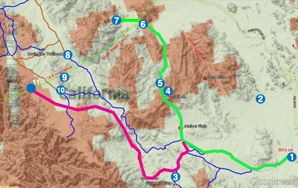
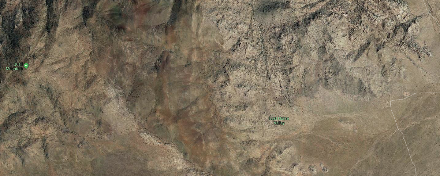
Map of the area from Tom Mahood’s website showing Verizon cell coverage and overlay of theoretical routes of travel for Bill and locations mentioned in this article, with overlays by me.
Locations shown: 1- Bill’s car at Juniper Flats Trailhead; 2-private inholding in the area, reached by private road not shown on map; 3-Stubbe Springs Loop Trail, where as-yet unidentified remains were found in May 2018; 4- Quail Mountain, Bill’s presumed destination (route of approach probably not precise); 5-area where Bill may have been injured; 6-likely location of cell ping in Quail Wash at northeastern mouth of Smith Water Canyon; 7-north side of Smith Water Canyon; 8-Lower Covington Trailhead; 9-High ground between Covington Trailheads where Bill might have possibly pinged his phone; 10-Upper Covington Trailhead; 11-Spot where a ping may have been staged, or where Bill’s phone might have gone off if he went to Upper Covington Flat.
Blue lines are existing trails in the region (the main one extending south from Covington Trailhead is the California Riding & Hiking Trail) and brown lines are dirt roads. The brown overlay is Verizon’s advertised coverage in the area. It is roughly accurate in the Smith Water and Quail Mountain areas but overstates coverage in the Upper Covington area. The 10.6-mile radius near which Bill’s phone apparently pinged Sunday morning is the curving green line.
Heavy green line is hypothetical route of travel if Bill went to Quail Mountain and then descended to Quail Wash. Red line is hypothetical route if Bill went to Upper Covington Flat after getting lost from Stubbe Springs Trail…note that the most logical topographical route, and the only one by which Bill can enter Upper Covington Flat without clearly seeing the road leading into it, takes him in close proximity parallel to the California Riding & Hiking Trail for some distance. Both routes assume the tracking dogs were correct that Bill first went up the California Riding & Hiking Trail to its intersection with old Juniper Flat Road.
The 10.6 mile range is particularly baffling because if one draws a radial line on a map from Yucca Valley, in the area between the cell tower and the car, it very closely aligns with the path of a deep crevasse known as Smith Water Canyon. Smith Water (SWC for short) was listed on one of Bill’s itineraries and Mahood theorized that Bill may have become dehydrated on his hike to Quail Mountain and rather than returning his car decided to bushwhack towards Smith Water Canyon about 2 miles to the north, where he is likely to have known that there is water year-round, and which he could navigate to the California Riding and Hiking Trail about a mile to the west and loop back to his car.
Though it is apparently the case that water is in SWC, it is difficult to find (I’ve been there several times and I’ve never seen it myself) but more importantly, both sides of the canyon are extremely steep and rocky – difficult to ascend and extremely hazardous to descend without the aid of a hiking pole, which Bill did not carry. I can attest from my own hair-raising trips down how easy it is to visualize a hiker breaking an ankle or otherwise immobilizing him or herself trying to negotiate their way to the canyon bottom.
The 10.6 mile line falling mostly along Smith Water Canyon, there are very few places where it is feasible for a cell signal, however brief, to get out. But the location is strange for another reason. It is far north of where searchers expected Ewasko to be, and there is much better and more consistent cell reception between Quail Mountain, where Bill supposedly was headed, and Smith Water Canyon. Why, then, did Bill’s phone not ping earlier than Sunday morning?
It’s been suggested that Bill may have been incapacitated, or died, with his cell switched onsomewhere in the vicinity of Smith Water Canyon where there is not normally reception, and known atmospheric conditions at dawn allowed a freak connection to occur. If that is the case, however, it suggests that Bill left his phone on for some time and that the batteries had not run down by Sunday morning. Since he was carrying a flip phone and not a smart phone, this could be possible, but it also begs the question why Bill has not been found, somewhere in presumably open terrain (for the cell signal to have gotten out), along that line with a cell phone nearby. Once the significance of the cell ping was realized, Tom Mahood and his allies (including myself) searched the southern slopes of SWC, where there are both many rock formations that could hide human remains and intermittent cell reception, very thoroughly, and also covered much of the rest of the radial line in subsequent searches. No verifiable trace of Bill was uncovered. Moreover, with any inaccuracy in the distance reading likely to occur closer to the tower rather than farther, all or nearly all of the places on the south side of SWC where there is cell reception are out of range.
The 10.6 mile radius is odd for yet another reason. If Bill got as far as that point and traveled onward, at that juncture he is close to rescue. Smith Water Canyon itself is a regular backwoods hiking destination. If he was on its west side, he would have been close to the California Riding and Hiking Trail and drive-in trailheads at Lower Covington Flat and further west at Upper Covington Flat. On the other side of the canyon, it would have been a longer slog to safety but it is only about three miles of unchallenging terrain to either Joshua Tree village (via Quail Wash) or Park Road (past Samuelson’s Rocks). It’s certainly true that in Bill’s likely weakened state, it’s possible that he just couldn’t cover any further ground at that point (more on this later). But given how well-traveled these areas are, and that they were covered by the search parties not long after Bill’s disappearance, it’s hard to understand why he wasn’t found subsequently.
Joshua Tree National Park is indeed huge, and though there is not a lot of tree cover, there are myriad rocks, boulders and yucca trees in the area where a person could have crawled into for shelter, expired, and not been found. Hikers go missing all over the country and are not found for months, years, or ever, despite massive searches. But the clues in this case, far from narrowing down the search, raise baffling questions. Why did Bill set out from his car with so little water (leaving 9 bottles behind in the trunk!)? Why did he leave Quail Mountain and head north (if in fact he did)? Why did Bill’s phone not go off until Sunday morning, when there is cell coverage south of the radius and it is less than two miles from Quail Mountain to the area the ping might have happened? If Bill was incapacitated and was not able to travel quickly, then after his phone went off, where did he go that he was not subsequently found? If he was that close to safety, why did he apparently eschew obvious easy routes of travel to help? How as he even able to survive for three days in the height of desert summer with as little as five, and possibly as few as two, 12 ounce bottles of water? Why was no sign of him having camped out in the area, or any of his belongings (such as one of the water bottles, or wrappers from the food he carried), ever found? And after an exhaustive search and rescue effort, first officially, then by Mahood and his helpers, and more recently as incidental to last year’s search for missing hikers Rachel Nguyen and Joseph Orbeso, why have Bill’s remains still not been found?
Anything might have happened, including myself, Mahood and all the people who searched inadvertently passing ten meters from Ewasko’s remains and missing him. But after looking at the case for several years and testing out a lot of theories of my own, I think the most likely answer is one of a couple of scenarios, which I will sketch out below.
Answer #1. Bill Hasn’t Been Found Because He Is Not There
After about three years of running down various theories and familiarizing myself with the topography, trying to game out various routes Bill might have taken and how he might have managed to wander around (or not) for 2 ½ days without his phone pinging, then pinging at 10.6 miles or thereabouts, and then getting to somewhere he could not be found, I go to a point where the whole thing just seemed to not line up. Every time I came up with a scenario to reconcile it all, I ran into trouble on the ground. The timeline and the topography, taken together, do not make sense in ways that it’s hard to understand unless you’ve actually gone there and looked around. After countless areas being searched, there are any number of things that might have happened, but it’s hard to have enough faith in any of them to act on that basis.
It was about this time that I started to consider for the first time the possibility that Bill couldn’t be found because he simply wasn’t there. The whole scenario was bizarre in the first place…the idea that Bill would head off alone in the desert with enough provisions for an hour or two day hike and wander so far away that he couldn’t make his way back. Most of the way from his car to Quail Mountain is an easy walk on either a trail or an abandoned road. If Bill had decided to continue up Quail, it still was not a difficult bushwhack and the location of his car should have been in sight most of the time. Why continue away from his car, into unknown territory? Mahood’s theory about going to Smith Water Canyon for water was a plausible effort to make sense of this, but on its own, it’s a stretch. How did he get so injured that he couldn’t simply walk (or crawl) out, and then manage to move so far out of the search area that he then couldn’t be found?
What if the reason it didn’t make sense is that none of this ever happened? What if the whole thing was a ruse?
I had rejected this possibility for years as being too “conspiracy theory” oriented – and indeed that’s how it still gets portrayed – but the more I thought about it, it made a lot more sense of the few facts available to us, and I could even see an odd scenario that might reconcile all of the eyewitness reports about Bill’s car.
Let’s say that Bill’s car was driven to the park sometime Thursday. Remember that it could have been as early as 10:20 a.m. or as late as 5:20 p.m., so there was plenty of time for things to transpire between Bill’s second-to-the-last cell recording on I-10 and the appearance of his car at Juniper Flat. Remember too that Bill’s senior pass was not scanned on the way into the park. Is it possible that it wasn’t used because whoever was driving did not want a record of their entrance into the park?
Bill’s car is then parked in a conspicuous way possibly so as to draw notice – not in the diagonal parking spot, but parallel to the curb across the painted lines. One set of footprints leads away from the car, on the most commonly traveled route away from the parking lot, and none lead back.
Then at some point the next day between 9 a.m. and 1:30 p.m., Bill’s car is removed. If Bill’s disappearance was planned to be staged from the beginning, I have no idea why this would have happened. My best guess is that something might have gone wrong – that whoever parked Bill’s car had planned to hike through to another location but could not make it, and was forced to return to the car and drive it out of the park, then having to improvise a new plan to return the car surreptitiously since Bill’s disappearance would have already been reported. If, however, Bill met with foul play while on his hike, whoever he met up with may have initially tried to get rid of the car and later decided it would be less suspicious to just put it back where it was.
So then how was Bill’s car returned, when all of Joshua Tree National Park was looking for him at that point? The positioning of the car gives us a clue. Remember that Mimi Gorman was adamant that when she passed the parking lot early Saturday afternoon, Bill’s car was parked back to front facing the road, and was able to correctly identify a sticker in the front windshield. But if someone drove the car back and reparked it, why would it be parked backwards? And why not just park it as it was left in the first place?
If, however the car had been transported to the location hidden inside of a U-haul or other transport vehicle, this would be how the car – driven into the U-haul head first – would come out. Whoever would have done this would have wanted to accomplish this as quickly as possible so they would not be observed by passing traffic. Immediately reparking the car in its original position, with the U-Haul likely blocking the way and also taking up much of the parking area, would be awkward, time consuming, and likely to draw notice. However, if the driver already checked nearby trailheads and confirmed either nobody was there or nobody was within sight hiking back to their cars, they could be reasonably certain they’d have enough time to back the car out and drive away in the U-Haul without being seen. It probably could be done in two or three minutes. Then they could drive the U-Haul someplace nearby (perhaps across the main road towards Lost Horse Mine) where it would not be connected to the abandoned car, and walk back to repark it – during which interval Mimi Gorman drove by.
Whoever reparked the car most likely was the person that left it there on Thursday, since they knew to park it parallel to the curb and towards the end of the parking lot. But again remember that the Habers on Friday morning also said the car was “a couple feet from the curb” – but photos of the car after it was discovered on Saturday clearly show only a few inches’ clearance from tire to curb.
If this is what happened, it had to have been a plan improvised under great pressure. There’s no logical reason to move the car and return it otherwise…and the person or persons that did it had to be very concerned that the car’s absence would be noted and that the police would investigate it as a criminal matter. It seems likely that that person would have wanted to make sure that that didn’t happen, and keep investigators focused on a missing hiker whose complete disappearance would not be flagged as being that unusual.
Remember that several of the first night’s searching parties claim that they saw lights at the nearest ridgeline from Juniper Flats trailhead. This has never been explained, but if it was a lost Bill, given the location of the cell phone ping the next morning, he would not have been that close to the parking lot at that point. However, it seems likely that Mr. X would have wanted to observe the discovery of the car and see how things went down – and certainly once the original ranger on the scene put up crime scene tape around the vehicle that concern might have heightened. The nearest ridgeline would be exactly where you would expect them to keep watch. The lights that were observed might have been inadvertent – Mr. X trying to find their way down from their perch and shutting off a flashlight when they heard the distant sound of searchers reacting to it – or on purpose, to draw attention away from the car and towards a hypothetical lost hiker in the minds of the searchers.
If this is what happened, whenever Mr. X made their way back to the U-Haul – which must have been tricky in darkness with a ranger sentry left to stand guard all night on the vehicle, alert to the possibility of Bill’s return – they could not have been breathing easy. There would have been no clear indication from seeing the brief search on Saturday night, and the late arrival of law enforcement, how this was going to play out. It makes sense that Mr. X would have wanted to take some further action to draw attention away from the car’s disappearing act and keep authorities focused towards search and rescue and away from a criminal investigation.
There was one obvious means of planting a false clue that would not endanger Mr. X – Bill’s phone. Whether this was a criminal enterprise or something pre-planned, it would likely have been known that cell phone records are (and were back in 2010) the first go-to in a law enforcement investigation of a missing person. If the cell phone could be tracked in a remote area that suggested Bill was mobile and heading into territory where he might not be found, it would likely do the trick. After what would have had to have been a harrowing afternoon and evening trying to stay out of sight of nearby authorities, Mr. X would also have known such a ping had to be nowhere near Bill’s car or anywhere in proximity of a search party.
Mr. X could not have known that the cell tower in the area was omni-directional and would not triangulate his or her exact location. So they would have had to pick out an area that was remote enough to suggest a large area that Bill might get lost in, far enough from the car and the search area so that he would not run the risk of bumping into law enforcement, but still easy to get to by car.
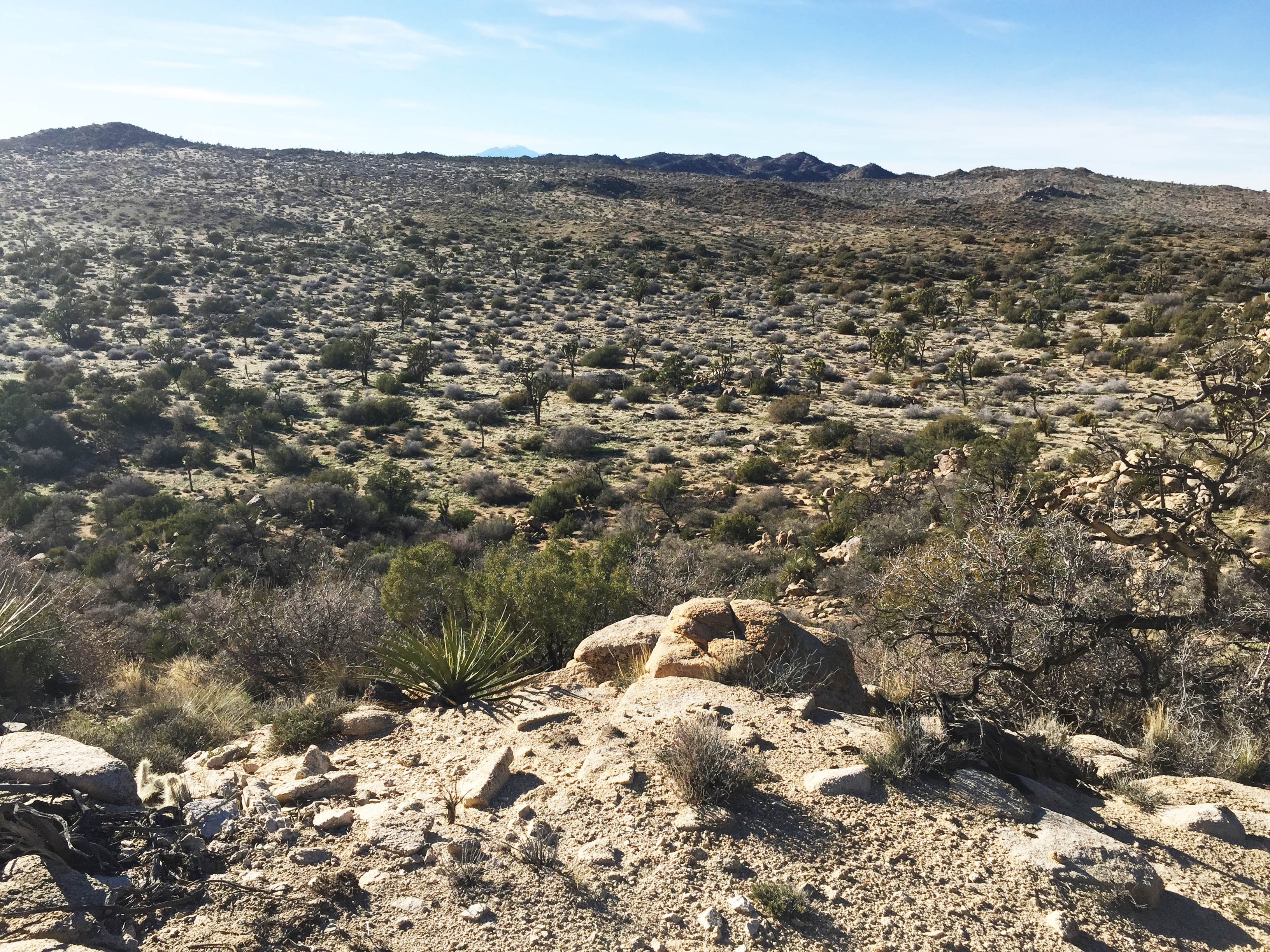
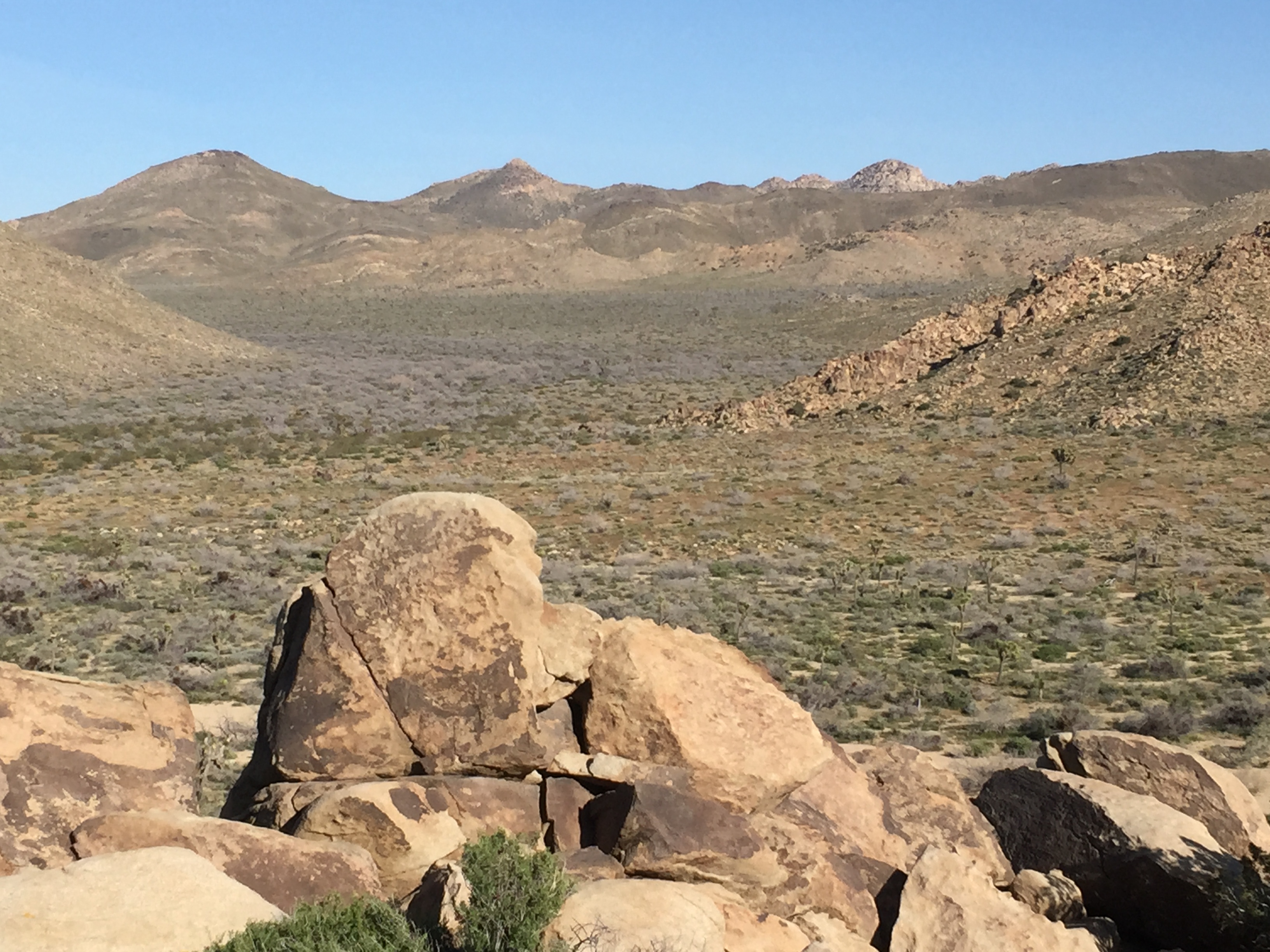
View of Upper Covington Flat from the high ground just to the west. The “ping spot” is in the vicinity of the upper left hand corner of the picture. It is an easy 15 minute walk through this terrain from the road.
Did such a place exist? Yes. About 10 miles northwest of Juniper Flats trailhead is an area called Upper Covington Flat, a large, mostly flat bowl valley area whose western ledge abruptly plunges into a hellish series of cliffs little traveled by hikers. And at the borderline of this area there are intermittent flashes of cell reception, at almost exactly 10.6 miles from Serin Tower. The pattern of reception in the area suggests strongly it is coming from that particular tower. And this spot could be reached easily by a normal passenger vehicle via a dead end road to the trailhead and a 15 minute walk through easy terrain. All that would be required would be to get up at dawn before the search was underway, drive 20 minutes from Yucca Valley, park the car, walk to the area, turn on the phone until it caught a signal and voice mails started to appear, turn it off again, and leave. Which fits what little we know of the time and characteristics of Bill’s cell phone connecting with the tower.
If this narrative – which can’t be in any way proven but which fits all the facts as we know them – has any basis in fact, then who is Mr. X?
Foul Play, Self Harm or Self Disappearance?
If Bill’s disappearance was a staged event, it must fall into one of three categories: foul play, self harm, or self disappearance.
On the face of it, self disappearance fits this scenario the best. Bill worked in finance and his disappearance was in the aftermath of the financial collapse in late 2008, though there’s no evidence that we know of that he was involved in anything untoward; it’s just a more suggestive line of work for this kind of act than, say, being a plumber. But if one was staging one’s own disappearance, doing it on the other side of the country from one’s own home (where it’s very unlikely your personal computer would ever be forensically examined), in a remote area with jurisdictional conflicts (you have Joshua Tree National Park plus both Riverside County and San Bernardino Sheriff officers responding), very close to an international airport and an international border, would be an attractive idea.
Bill also left multiple lists and maps at his condo and was apparently unclear about his destination with Mary Winston (or she misunderstood him) even though he had already written out directions to Juniper Flats trailhead from the west entrance to the park (the opposite direction from Carey’s Castle) and must have known exactly where he was headed. Despite that unclarity, he left Mary a precise time that he’d be out of the park, one late enough to almost ensure no searching was done the first night (which it wasn’t). If one wanted to create confusion and delay a search, they couldn’t have gone about it much better.
Bill would have known exactly where he parked his car, and would have been at little risk at any point in the undertaking if he had been discovered; he could simply claim a misunderstanding or some kind of hiking mishap if he was encountered by any law enforcement or search party, none of whom were looking for someone staging their own disappearance; they were looking for a lost hiker. It would have been easier for Bill to stage the phone ping as well, since he’d already know who his provider was (Verizon) and could investigate their coverage map online in advance of the trip. Bill also was in reconnaissance in Vietnam and would have had the chops to hide out in natural surroundings and make his way back to his own car undetected.
The self-disappearance theory has some flaws, however – and it should be stressed that there is absolutely no concrete evidence that this is what happened. Bill’s fiancé Mary Winston vehemently denies this possibility, pointing out that he had family ties back home – a newly born first grandchild, and an 85 year-old mother still alive and who was about to undergo hip surgery. But setting that aside, while overall it fits the known facts well, there are two details that really work against the self disappearance theory to me.
The first is the sighting of Bill’s car on Friday morning. If Bill was planning to stage his own disappearance and for some reason (failing to rendezvous with a pickup elsewhere, for example) had to change plans and drive himself out of the park, I don’t understand how that would have kept him away from the car throughout the night and into the next morning. It’s of course possible; Bill could have run into trouble hiking in this scenario as well as any other…but it still doesn’t track with the small amount of water he brought, nor the fact that searchers shortly after found no evidence of Bill having camped out anywhere in the immediate radius of the parking area. Getting the car back in the park would be a bit risky, but again, if he was caught, he wouldn’t be in any trouble. No crime would have been committed, and he could chalk it up to a misunderstanding. (Driving the car back in, however, and running the risk of the license plate being made at the gate, would be inviting trouble, which would explain the elaborate U-Haul scenario)
The second detail that doesn’t fit are the water bottles left at the condo and in the car. If Bill pre-planned his own disappearance for the next day, then why buy a crate of water and leave most of it in the trunk or back at the condo, given that he would have known he wouldn’t be back to either location to drink it? I suppose one could argue that this could be an obsessive-compulsive detail to further throw law enforcement off the scent. If so, that indicates a pretty deep level of pre-planning.
Self harm is hard for me to fathom. Going by personal experience, if I was contemplating such thoughts but had an elderly mother still alive, I’d try to wait until she had passed. However, people suffering from depression behave unpredictably and not always with regard to their loved ones; anything’s possible, although again I have to stress that we have absolutely no evidence that anything like this was going on with Bill. If someone was going to take their own life, doing it far from their own loved ones, in an area they were fond of, and in such a way that it would be chalked up to a missing hiker – that’s certainly a plausible scenario that we have to consider. However, if that was the plan, then there’s absolutely no reason to return the car, drive it out of the park, and then drive it back again. If Bill did indeed stage a suicide, then we would have to again disregard the conflicting eyewitness reports about the car as being mistaken.
Which brings us to foul play. For a long time I personally dismissed this scenario for a very simple reason; though the Mojave Desert is a big place full of wide open places where people who like privacy do some very hinky things that would not necessarily be healthy to run across, the area Bill disappeared is remote, inaccessible by car, and sees little visitation. The idea that Bill would run across some kind of illegal activity – or just a bad actor of any sort – on the trail is really hard to credit. Moreover, if Bill was killed on the trail, not only should there have been blood evidence found by the searchers, but the killer would have had to dispose of Bill’s body, by hand, on foot, and in such a way that searchers did not find it later. That would be no small task.
It’s easier to imagine Bill having run into trouble at the parking lot, but the problem here is that there was no evidence of a struggle nor of any other human presence save the one set of footprints walking down the road, nor did police investigators observe anything to suggest a crime had been committed in the parking area…and again, you run into the problem of the car apparently being there overnight and then disappearing late Friday morning or early afternoon. If there something did transpire at the parking area, then it only makes sense if it happened around the time the car was moved. But if that was the case, then where was Bill all night? Too many coincidences in that scenario.
Another possibility would be something happening to Bill before he ever got into the park. As we’ve already noted, there is a gap of time unaccounted for of at least an hour, and we don’t know for sure Bill’s car was there until many hours later. Bill’s senior pass was never scanned at the park entrance, which might imply someone who didn’t know it was there or didn’t want the entry recorded. We do have one set of fresh footprints Thursday evening leading away from the car, but they’ve never been confirmed to be Bill’s. Since Bill had printed out directions to Juniper Flats, it was even possible for a third party to know where Bill was headed. Once more, it’s hard to understand the car’s apparent disappearing act, but it would again imply some sort of a plan to rendezvous with another way out of the park that fell through.
To our knowledge the car was never processed as a crime scene so we don’t know if anybody else had been driving it – but since the car was a rental it’s unclear that any such evidence would have been useful anyway. What we do know is that there was no sign that anybody else was ever in the car nor any sign of foul play in the car, and things were left on the passenger seat. So if something happened to Bill outside the park, it almost certainly happened outside of the car and he never returned to it again. This scenario seems possible, but it requires a lot of things to happen that are hard to believe; unless Bill knew people from previous visits to the area that he got into trouble with, it’s hard to imagine how he would have gotten into a fatal problem unobserved by witnesses, say, stopping at a convenience store on the way into the park for a Coke.
So, none of these scenarios seem to be particularly likely…but there is another possibility that was not immediately obvious at first. As I said above, it’s very hard to imagine a foul play situation taking place on the trail. On foot, with no vehicular access to remove a body or to bring bad actors into the area, it’s just logistically too difficult to credit.
Screen grab from Google Maps showing Quail Mountain at extreme left, and a private inholding with dirt roads leading to it at extreme right. EDIT: Please note we have absolutely NO evidence of any criminal or other activity happening at the private inholding – only posting to show that private roads, and theoretically private parties, including ones accessing the area illegally and without the landowner’s knowledge – are within the vicinity of the area where Bill went missing, so foul play cannot be technically ruled out owing to inaccessibility of Bill’s path of travel.
However, it turns out there is a private inholding in the park not far from Quail Mountain. The cluster of buildings lies about 2000 meters north of where Bill’s car was parked and 3000 meters east of Quail Mountain. If Bill got into trouble somehow on the hike, it is a much more logical area for him to have descended this side of the mountain (towards his car, and ranger stations to the east) to look for help than heading for Smith Water Canyon. Again I have to stress that there is no evidence that anybody connected with that private inholding has participated in anything criminal. We have no information at all. But without knowing more one way or another, if there is private land accessible by vehicle within Bill’s range of hiking (which emphatically is NOT the case in any other part of the park Bill might have wandered), we can no longer practically rule out Bill having run into foul play during the course of the hike. It’s possible that rangers or the police looked into this possibility, or know enough about that inholding and its occupants (or the accessibility of the road itself to outside visitors not connected with the property) to rule it out, but there’s no indication in any of the available records that that happened.
If Bill did go looking for help and inadvertently stumbled on some kind of criminal enterprise (EDIT: or conceivably happened upon target shooting activity by accident) in this area that got him killed, the timeline does then make some sense. It’s easy to imagine it taking a period of time for bad actors to figure out where Bill came from, where his car was, and decide what to do about him. It’s also easy to imagine a scenario where such people would initially act instinctively to get rid of the car (or try to fence it), then think it over and realize it was much less suspicious to put the car back where it originally was. That kind of scenario implies people that weren’t necessarily forward thinking and reacting to events under pressure, but had enough ingenuity and understanding of police procedure to decide it was worth the risk to return the car and to stage the cell ping. I think this theory is plausible – but again I have to stress we have absolutely no information about the private inholding or anybody that might have been present there on the day Bill disappeared, so it’s impossible to know how likely it is.
So that runs down the various possibilities if the ping was staged. But as I will be the first to admit, the whole scenario, while it fits most of the facts, is still a little hard to believe. The more conventional explanation would be that this really is simply another case of a hiker who wound up somewhere unexpected. After all of the analysis by Tom Mahood and others (including myself) of the topography, previous search tracks, and the radius of the phone ping, is there anyplace left to look? Is there anything we can deduce from the few actual clues and the mountain of negative information? Perhaps. We’ll look at that next.
Answer #2 – Bill Is There, But In A Very Unusual Place.
Analyzing The Clues
Before we get started on this, let’s admit one simple fact that many have pointed out: Joshua Tree National Park is huge, a dead body is small, and there are a lot of rocks. Bill could be anywhere, and Tom, myself or any of the other searchers could have walked right by him and never seen him. This is absolutely true, though in that environment where there is nearly no trace of humans the remains of Bill’s possessions and clothing should stand out.
It doesn’t, however, make the question of where Bill actually is any less puzzling, since based on the facts we know and the searches that have been done, there are few logical places left to look. Since the time a few years ago when I came to the personal conclusion that the ping may have been staged, I have come up with a few alternate more conventional theories that are at least plausible, and more recent searches by others have expanded on those areas. Nothing however has been found and to me, if Bill really did go missing in the park, then something about our understanding of this event is simply wrong, because the few clues as we know them – the timeline, the location of the ping, the topography, and the failure of Bill to be located or walk out on his own — just don’t add up.
For the purposes of trying to figure out what this might be let’s assume – as law enforcement, JTNP and Tom Mahood have all done – that the eyewitnesses that indicated Bill’s car had been moved were simply mistaken. This is certainly possible, and there’s no way I can think of to reconcile the movement of the car with a simple lost hiker scenario.
The most obvious place to start asking questions is the mysterious cell phone ping. The recent article in The New York Times Magazine and other websleuths on Reddit and elsewhere have called into question whether the 10.6 mile reading is as accurate as has been assumed. The Orbeso-Nguyen search last year offered further evidence as their phone pings turned out to be fairly far from where they were actually located, though it actually benefited the Ewasko search in that it sent searchers into areas that were still possibilities for Bill to have disappeared in, most notably the steep escarpment above Quail Spring. However, that was a question of triangulation, not of distance, which from everything we’ve been able to glean from people who know about such things, is probably accurate.
I don’t believe, moreover, that throwing the ping out changes the picture all that much. Here’s why. Firstly, search and rescue was undertaken before the range of the ping was known, in areas closer and more logical to where Bill was parked. Mahood’s early searches continued along these lines, and he only began to focus on the ping radius after the searches came up empty. There’s a reason the ping was ignored – as I’ve already noted, it didn’t seem to be in a logical or probable place.
It is very unusual, though certainly not unheard of, for a search and rescue effort in Joshua Tree to fail to find a body (it happened again, in the exact same area, in 2016). The phone pinging so far north, and not pinging earlier when the intervening areas have much more cell coverage, is another unusual event. Moreover, the cell phone pinging Serin Tower strongly suggests that Bill was at least north of Quail Mountain at that point, since if he was on the lee side of the mountain there likely would not have been any reception or if there was it probably would have hit another tower to the south.
Even though the accuracy of the 10.6 mile radius has been called into question by some, nearly everybody seems to agree that, owing to the dynamics of cell phone propagation and simple physics, any error almost certainly would place the phone closer to the tower, not farther away. Mahood originally put that outer limit at 11.2 miles and later suggested after further consultation with cell phone experts, including one who did field testing in the area, it might be as little as 10.85 miles. I spent a lot of time in that area with my Verizon phone, and it’s significant that south of Smith Water Canyon, you can start to get Verizon reception at around 10.9 miles from the tower, and more and more reception the further away you go (and the further up the south side of the canyon you climb). So in that specific region, the further away you are from the tower, the more likely you are to connect to it – and the less likely it is to be the location of Bill’s ping.
That, and the fact that Bill was only able to connect briefly once, two and a half days after he disappeared, suggests that Bill was not further south than 10.6 miles (or 10.85 miles if you like). If he had been, one would expect that he would have been able to connect earlier and more than once. He would also have been closer to Quail Mountain and the primary search area and his phone would have been silent for two days in an area where there is a substantial amount of cell reception. True, he may have been injured in a dead zone…but if so then how was he able to later move to another area, ping the tower and then vanish to yet another place?
So because owing to basic physics and the reflectivity of the rocks in the area, it is far more likely that an error in the cell reception puts Bill closer to the tower. But location-wise that doesn’t make sense either. Remember again that the 10.6 line closely follows Smith Water Canyon…so anything shy of that puts Bill on the steep walls of the north face of the canyon – not only difficult in terms of Bill’s physical ability but it puts a huge wall of rock between him and the cell tower. If we place Bill further west of this area, then going north of the 10.6 mile line quickly puts Bill at one of the Upper or Lower Covington Trailheads, with drive-in parking lots at each and a ranger visiting them just a few hours later. If we place Bill east of Smith Water, there are clear topographical lines of travel to safety that see regular local traffic and also have been searched.
So unless we’re willing to discard the ping entirely as a glitch in Verizon’s system – and let’s remember the technician was reporting to the police a figure of 90% accuracy, so he had some skin in the game here – as improbable as it is, I think the 10.6 mile reading is likely fairly accurate. Let’s also keep in mind that the failure to find Bill itself is unusual, which suggests he was somewhere he wasn’t expected to be by Sunday morning. As little sense as it makes, given the timeline, topography, pattern of searching and cell reception, putting the call anywhere closer or further away makes even less sense. And yet it leaves Bill few places to have been able to ping the tower, even in a fluke, and few places to move on from there where he would not be found.
So if the cell ping isn’t wrong, what is?
What Lost Hikers Do
Much of the analysis of where Bill might have went has been based on two not unreasonable assumptions – that Bill had a rational plan for finding help, and that his physical condition after nearly three days in the desert summer would severely limit him physically. But are these valid assumptions – or even if they are valid, are they leading us in the wrong direction?
There are actually many examples in search and rescue of people in extreme conditions of dehydration and exposure both acting bizarrely and undertaking physical feats that would seem to be beyond them. To use one recent example, in 2014, an off-duty firefighter went missing in Los Padres National Forest after he ran away from his campsite to chase a lost dog. Despite being barefoot, clad only in shorts and a T-shirt, his body was found 1,200 feet above the campsite in rugged terrain. Not only could anybody fathom why he climbed so high, it was hard to believe that it was physically possible clothed as he was.
But even more on point to Bill’s mystery is the fate of another hiker roughly the same age as Bill who went missing in Joshua Tree only a few months later. Consider Ed Rosenthal, who went missing in the Black Rock area in September 2010 and was recovered, alive, six days later.
Like Bill, Rosenthal set out with only a limited amount of water which was exhausted by the morning of day two. When he recounted his experience to the Los Angeles Times in October 2010, he said: “See, so much of this is, I don’t know why I did it…there’s an amazing energy around. It’s not about me, this whole event. I never had that kind of energy to walk 25 miles. I never hike like that.” Rosenthal further spoke of unusual physical feats coupled with mental confusion, walking with a “vigorous stride” for miles and miles after becoming lost. “I started jumping into these canyons which I’ve never done,” and later woke up without being able to remember how he got to his current location.
A less prosaic case happened earlier this year when lawyer Paul Hanks was found by search and rescue, alive, five days after he went missing in JTNP. Hanks had been injured in a twenty foot fall, suffering multiple fractures. Despite that, and relevant to Ewasko’s case, he was able to crawl several miles and even managed to find rainwater and eat cactus for sustainance. Yet another hiker, David Sewell, was found alive and conscious after three days in the park just last month…despite being in his mid 70s and legally blind.

Another famous recent case of a missing hiker, not in JTNP but in Maine, is of that of Geraldine Largay, who went missing on the Appalachian Trail in 2013. Ms. Largray had strayed off the main trail to relieve herself and became lost in the surrounding woods. Apparently Ms. Largray, who like Bill was in her 60s, had a history of getting turned around on the trail and this was the only stretch of her Appalachian hiking trip she had undertaken solo. Unlike Rosenthal’s story, Largray’s case does not parallel Bill’s in that it was someone well-provisioned and in a different part of the world, but it offers some insight as to how someone might behave in a situation where they are alive but isolated from the search, why missing people are not found, and how long people can survive even after the search has been called off.
According to an extensive Boston Globe article about Ms. Largray’s disappearance, after she could not find her way back to the trail and tried to text for help, explaining her predicament. When the text did not go through, she looked for higher ground to get cell reception. Not finding it, she pitched a tent and stayed overnight. She made a second attempt to text out the following afternoon, with no success. After that point, Ms. Largray did not stray far from her tent, and tried to attract the attention of search helicopters by various means, with no success. Significantly, she apparently did not try to text out again for another two weeks (behavior similar to two hikers who went missing in Panama in 2014 whose cell phones showed decreasing activity after an initial flurry of attempts to call for help, with the last use of one of the phones coming after five days of disuse). Tragically, Ms. Largray eventually died from hunger and exposure, but was able to live at least 19 days, well after searchers had given up looking for her. She was found just 2,300 feet from a well-used trail.
Perhaps significantly, when facing death, both Rosenthal and Largray took time to write notes to their loved ones and to explain what had happened to them, making practical preparations for such things as funeral arrangements and in Largray’s case chopping up her credit card so that nobody could find it and use it.
What’s interesting here is that in both these cases, the lost hikers were practical and rational about mundane things, but showed poor awareness of their physical situation. Largray tried to follow hiker protocol (going to the bathroom 80 meters off the trail, staying put when lost), which inadvertently allowed her to get lost and then to miss finding an exit route close to her campsite – sad proof that sometimes without situational awareness, just following the rules often doesn’t work out. Rosenthal by contrast went into the desert poorly prepared and covered a large amount of ground sounding almost as if he was in a trance. Ironically, Rosenthal was the one who survived his ordeal. By the parallels and contrasts of these cases, and of other similar ones, can we return to Bill’s case and make some better guesses about what he might have done? Let’s try.
If Bill Is In Joshua Tree, Where Is He?
If we assume, as police and later Tom Mahood did, that eyewitnesses were mistaken about Bill’s car and that this is simple case of a lost hiker, and that the cell ping actually came from Bill’s phone and is roughly accurate as to its distance, we can then assume a few more things with reasonable certainty.
If his phone did not go off between Thursday morning and Sunday morning, then Bill must have had the phone powered down to save batteries at the time he entered the park. Since there is Verizon coverage all over Quail Mountain, assuming he went in that direction he did not turn his phone on again until he got into trouble. We can further assume that Bill was in a cell phone dead zone when he did get into trouble, and we can assume that he stayed in a cell phone dead zone for the next two days, since he had it off when he got there and in order for the battery to still be live on Sunday he most likely did not keep it on for two days straight after he got into trouble (nor would there have been any reason to, though he would have likely used the cell’s readout as a primitive flashlight during the night).
If Bill really did go up Quail Mountain, that means he would have had to have been in a small roughly 2 mile by 2 mile area between Quail and the north slope of Smith Water for that entire period. That is problematic, because that strongly implies a serious injury, and yet if Bill had expired where the phone pinged, he very likely would have been found by now, so he was still mobile enough Sunday morning to get far enough away that he would not be found.
This bothered me enough – along with questioning whether Bill would have really set out cross-country for Smith Water in the first place, an objection again raised by more recent searchers who have tried to retrace Bill’s steps up Quail Mountain — that when I was in Joshua Tree searching for Bill I formulated a few different theories that had him routing to different areas. If instead of going to Quail Mountain Bill simply went up the California Riding and Hiking Trail towards Smith Water Canyon he would have been in a cell phone dead zone the whole way — but it would seemingly be difficult for him to get lost or injured on that route, and at the 10.6 mile radial point on the trail he is almost at Lower Covington Trailhead.
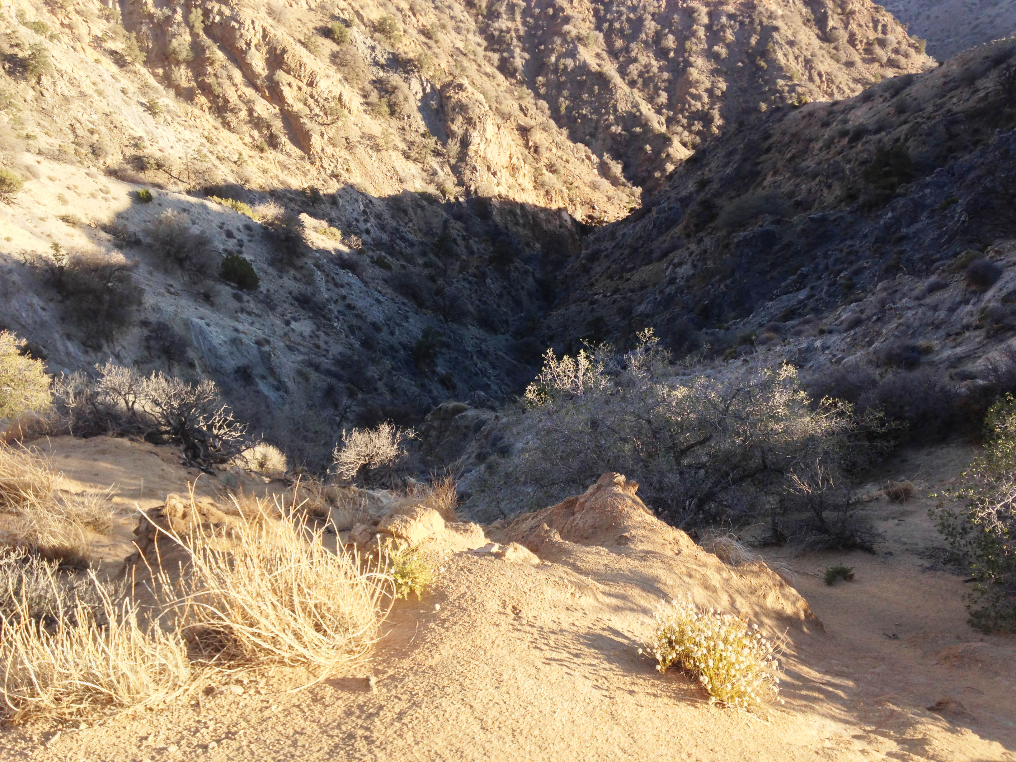
More plausible was the idea that he took the loop trail to Stubbe Springs, mistook a wash for a trail, and wound up in a deep canyon far to the west that might have been difficult for him to get back out of (rangers had thought of this possibility fairly early on, and did search in this area, but not further west than Stubbe Springs). This would explain why no trace of Bill bivouacking had never been found, and why it took him so long to ping the tower – the whole area has little to no cell reception, there would have been less of a vantage point to assess a way out, and there was a lot more (unsearched, then and now) room for Bill to rattle around in before he hit the 10.6 line.
I spent a lot of time running down these theories and though I can’t rule them out completely, I no longer think this scenario is the most likely. Because what I’m going to write next hinges on it, I need to explain why this is.
Why I Don’t Think Bill Is In The Covingtons
If Bill got lost near Stubbe Springs, the flow of the topography is such that he almost inevitably would wind up in a large canyon that runs south from Lower Covington. For him to have pinged Serin Tower at 10.6 miles (or most likely to have pinged it at all) he would have had to have gone north at some point in this canyon.
I spent a lot of time on the theory that Bill went from this canyon to the next area to the west, Upper Covington, to the same area where I suggested above that the ping might have been staged. After several trips to the area I decided that this was very unlikely. The reasons follow.
I discovered there is only one place to enter Upper Covington Flat from the south or east and not immediately see that there is a large road running into it, which theoretically would have drawn Bill to it rather than to the place where the ping happened (to get there he also would have had to have crossed a small trail and missed it, but I think this is possible). But more problematic still is that to get to that point, he would have had to move out of the north-south canyon that runs south from Lower Covington uphill against terrain almost within sight of, and possibly even on, the California Riding and Hiking Trail, which comes in from the east to follow the canyon north at that point.
View down into the dramatic plunging terrain on the western edge of Upper Covington Flat.
And then assuming Bill had gotten to the ping spot, he either should have been found there – and both Tom and I searched that area very extensively – or he went into the badlands to the west…and given the near impossibility of navigating the terrain which plunges away dramatically at this point, I have a hard time believing that Bill, no matter how mentally incapacitated, would have ever done this. Tom Mahood and another more recent searcher have made attempts to clear this area (I never found a way in that I thought was safe), but of course that’s impossible to do safely. He might be there. But if he is I would have to conclude that this really was an elaborate suicide. Past a certain point it’s not that far removed from deliberately walking off a cliff.
Another theory that I batted around and has since been mooted by a different searcher is that Bill kept going up that same canyon, met up with the California Riding and Hiking Trail (or possibly was on it the whole way), and before he reached Lower Covington Trailhead, very close to the 10.6 mile line, he went up one of the nearby hills to try and get cell reception and expired there. Between the two of us (on hikes a few years apart), we searched hills to the north and south and found nothing.
He could certainly be there and we missed him, but I personally don’t buy it. Firstly, if Bill got to this point, just south of Lower Covington, I would think climbing a hill would be the last thing he would do. Lower Covington Flat with its drive-in trailhead is only a half mile north, Smith Water Canyon with the promise of water (that presumably Bill knew about) is just to the right, and to the left is a trail leading up another canyon that from that point is suggestive of water in that direction as well (and which trail leads directly to the drive-in trailhead at Upper Covington Flat).
Secondly, once that hill is climbed, from that vantage point the roads are easily visible, so why stay there? I had a theory that Bill might have seen the ranger driving in to Upper Covington Flat Sunday morning and hurt himself trying to get down to meet her, but I didn’t see any sign of this and the terrain, while somewhat difficult in spots, didn’t seem all that dangerous. After three visits, even though there were a few areas I hadn’t covered, I just couldn’t believe in this theory enough to go back again to search through the resolutely uninspiring terrain that remained unsearched.
It’s also been suggested (by Ric Capucho, a hiker from Switzerland who has taken an active interest in the case) that perhaps Bill actually made it to the drive-in trailheads In the Covingtons but in the height of summer, found nobody there and moved on. Having been there many times and finding little to no traffic, I think this scenario is possible. I did search the sides of the roads going into the Covingtons a bit but again, it didn’t seem like it was worth the effort. A ranger did drive into the area just a few hours after the ping to look for Bill, as well, and searchers were cognizant of this possibility, so again, though it could have happened, I just don’t buy it.
So I can’t rule out Bill came this way, but after many trips here trying to prove that he did, and seeing how it looked on the ground, the scenarios that put him here require too many leaps – him having to miss this trail, or that road, or eschew that obvious easier path to safety – for me to believe them.
If Bill did get lost in the park, I think he most likely did exactly what searchers and Tom Mahood assumed: he went up Quail Mountain and ran into trouble when he got off the trail for some reason. And the answer to the riddle of why he wasn’t found by any of the subsequent searches may indeed lie with the cell ping…but the clue it offers may be different from what we thought it was.
The Cell Phone Probably Went Off In Quail Wash
In 2016, after I’d more or less given up searching because I had come to believe Bill probably wasn’t there (and if he was I had no idea where to look), I went over the information one more time and as so often happens, caught something I hadn’t seen before.
As I detailed in one of my write-ups, though a freak cell connection could theoretically occur anywhere (provided the phone was turned on), because of the proximity of the radius to Smith Water Canyon there were only a handful of spots where that was likely to happen. The most consistent (though still intermittent) reception along the whole line is to be found in the flat area of Quail Wash that lies just beyond the northeastern mouth of Smith Water Canyon.
View of the flat area at the northeastern mouth of Smith Water Canyon. The area where Bill’s phone may have pinged – Quail Wash – is in the green area in the middle of the picture. Note that there’s a clear view to the east and to the west from this spot.
I had previously ignored this for two reasons: from that point all the topographically logical exit routes are fairly well traveled and his body should have been found, and searchers were in the area the same day Bill registered his phone call. If Bill were moving slowly, he should have still been in the vicinity and he should have been found.
I realized reading over the search information that it was not clear exactly when searchers got to the Quail Wash area on Sunday. And after checking with Tom, I discovered it wasn’t until they were on there way out – late afternoon, 10-12 hours after the phone went off. By that time, even if Bill were crawling, he might have covered a lot of ground. So he could have easily been in Quail Wash with his phone and been long gone by the time any searchers arrived on the scene.
Unlike the Covingtons, Bill winding up in Quail Wash makes all kinds of topographic sense. If so, Bill must have run into trouble in that cell dead zone north of Quail Mountain. Why in the world he would have gone in this direction from the approach to Quail Mountain is still baffling. Subsequent searchers have pointed out that while the hike to Quail Mountain on a hot summer day was plausible as the area is kept cool by breezes on the high ground, that’s not true of the area north, and it would not have been an inviting destination, particularly as it took him away from his car. We simply don’t have an answer for that, and aside from the eyewitness discrepancies about Bill’s car, it’s one of the biggest red flags of the whole case.
Be that as it may, while he may well have set out towards Smith Water Canyon for water or just to cross it off his itinerary – or conceivably just went off trail a short ways to take pictures and lost his way or fell – all of the canyons he would encounter moving northward towards SWC empty north and east towards Quail Wash. If he did continue north he might well have come to grief in the really awful descents towards Smith Water Canyon or Quail Springs, but Tom and his cohorts (including myself) extensively searched the former area and as it happens besides Tom and myself, rescue teams in 2017 also searched the latter, running down what turned out to be misleading cell ping traiangulation from the Orbeso-Nguyen search.
If this is what occurred, Bill was almost certainly injured. However, this does not mean he was not mobile. I can chime in with some personal experience with this, having just broken my ankle (ironically not in Joshua Tree but standing on the side of the road here in Bali), that with such an injury Bill would not have been able to walk or put any weight on that leg, but he would have been able to hop, and if he was able to find a stick that supported his weight (difficult in that environment but, considering he had several days to look for one, not impossible), he would be able to navigate after a fashion.
And he would have been able to crawl. And we know from Paul Hanks’ case he may have been able to crawl several miles.
As Tom Mahood has pointed out, this may explain one of the most baffling parts of the mystery – why after the first few footsteps searchers were never able to find any footprints for Bill. It’s not a surprise on the well traveled paths up Quail Mountain, but it’s puzzling in the back country where few visitors go and footprints stick out. Searchers might not have recognized drag marks for what they were.
In this scenario, the 2 1/2 day gap between Bill going missing and the phone pinging is still puzzling. He has to be mobile enough to get to the 10.6 mile line (and it’s far easier to imagine an injured man navigating to Quail Wash than to SWC), but still immobile enough not to move to an area where he could have gotten a cell call out at a time when he certainly must have desperately wanted to. But having given this further thought, this is less mystifying than why he went into that area in the first place. Again drawing on my recent experience, one possibility is simply that immediately after the injury, the pain and trauma may have been such that he simply was unable to move, but after immobilizing for several hours (or days), this subsided. He also may have stayed in place, as Geri Largray did, awaiting help, but after a day or two with no evidence of a search in his area may have decided that his fate was in his own hands. It could also been as simple as it taking him that long in that area to find a long enough piece of wood to use as a walking stick – an explanation I particularly like since it would explain why he might have been able to undertake a climb later but why at this early point he did not make the obvious move back up towards Quail Mountain to the trail he had just come from, where he would gain elevation (and cell reception).
It’s also worth noting that the area where the phone may have pinged is near a spot clearly marked on maps as Quail Spring. Though it is labeled as dry (and is), Bill may have seen the spot marked on a map (though we do not know if he carried one, he was apparently interested in maps so this is a safe assumption. There’s no way to know the level of detail or coverage, though this has been a point of speculation) and figured it was his best shot at finding water in his current situation.
Getting down to Quail Wash would have been difficult for an injured man, but far easier than continuing towards Smith Water Canyon, since he would have not just have had to go into deep washes but climb back out of them. The obvious route would have taken him to a large wash which has high walls on each side that would have to be negotiated to enter it, but is wide and relatively easy to navigate once one is inside, and empties more or less directly into Quail Wash.
Therefore the timeline and the lack of a phone ping on Thursday, Friday or Saturday makes much more sense if Bill ran into trouble relatively close to Quail Mountain and then had to slowly and painstakingly make his way downward. Whatever the reason, following that route, once he was north of the cell coverage zone around Quail Mountain, he would have been in the dark all the way to the ping area – unlike the route to Smith Water Canyon, where it would be hard (though not impossible) to not ping the tower well before hitting the 10.6 mile mark assuming Bill was turning on his phone regularly to check for reception – which he must have been.
Once Bill got all the way down from the mountains into the Quail Wash area, topography would continue to push him north until he got into the rough area where the ping likely happened, just east of the northeastern mouth of Smith Water Canyon.
At that point (excluding the direction he had just come from) he would have had three obvious ways to go: entering Smith Water, which held possible water but also narrow openings and dry falls that would have been difficult to navigate; east three miles to salvation at Park Road through terrain not terribly difficult for an able hiker but sloped uphill and covered with small brush; or north about four miles to Joshua Tree Village by continuing up the wash. This would have been by far the easiest way to go to somebody that was injured or crawling. The wash is wide and fairly clear of brush, though in the middle of a wide flat area and without much cover it would have been very hot once the sun came up.
I searched this not-very-large area several times on the assumption this is the way Bill would have gone, but found nothing…and there really is only a mile for Bill to cover before it turns into an area that sees a lot of day hiking by locals, along with a clearly defined trail. If Bill got to that point, he should have been found. And yet, apparently he didn’t.
So where did Bill go?
If you look at the search tracks of the area on Tom Mahood’s website, one area sticks out as having not been searched: the north side of Smith Water Canyon, particularly the area adjacent to this spot.

The desolate, rugged and largely unsearched terrain north of Smith Water Canyon.
There is a reason for this. There is seemingly no earthly reason for Bill to go that way with so many easy exit routes at his disposal, and overall, the ascent up the north side of Smith Water is brutal. People have looked around there, including myself, and it has drawn more attention by more recent searchers, most particularly Bret Lamb, but even then the highlands and area closest to Lower Covington have seen most of the visitation. Except for a brief look on my very last trip there – where New York Times Magazine reporter Geoff Manuagh dissuaded me from going further owing to the lateness of the day – no one has looked at the north side of Smith Water Canyon at its northeastern mouth. Though the ascent in that area is still challenging, it’s less so than every other part of the canyon. That said, even for an able-bodied hiker, it would be a taxing ascent, let alone for someone injured and possibly crawling.
Nobody has ever looked here precisely because no one could imagine any reason why Bill, with three easier directions to travel in that offered the promise of safety in the form of water or rescue, would do something so insane as to go straight up the north side of Smith Water Canyon. What in the world would make him do that?
I think it may have been because his cell phone pinged.
Bill Is Most Likely on the North Side of Smith Water Above the Northeastern Mouth of the Canyon.
At the risk of being insensitive, but for the sake of trying to understand what he may have done in this scenario, let’s put ourselves in Bill’s hypothetical position at dawn Sunday. He’s been out for 2 ½ days and has probably exhausted his food and water. He is almost certainly injured and in pain. He probably is crawling or moving slowly with the aid of a walking stick, and any decisions at this point he makes he does not have the physical resources to back out from.
Because of where he most likely was injured and because he probably has not been able to stand or climb well, he may not have been able to see the surrounding area when he was on high ground, so he may or may not know that he is three to four miles from getting help at that point. But he almost certainly has been periodically powering up his phone and for the first time, he gets a signal. For a split second. A text comes through, a voice mail, something. And then it’s gone, and he can’t get it back (I can personally attest to the on again, off again nature of cell reception at this location) – it’s been speculated that this specific ping may have occurred at the time it did (just after dawn) because of a phenomenon called “ducting”. Or possibly it’s just dumb luck.
Some, including the investigating detective, have theorized that at that point the battery crashed and the phone died. That is certainly possible…but we know his phone was off for the first half of the day Thursday; he was already conserving his battery at that point. We know from the stories of some of the vanished hikers above that their phones, owing to battery conservation, were still active nearly two weeks after their original disappearance. There’s no reason to think he would have turned it on after he got in trouble and just left it on. Even if he turned on his phone 12 times a day to check for a signal, and then turned it off, it’s likely he would have still had some battery left on Sunday. If he was immobile for some of the two and a half days – and to have covered so little ground he likely was – there would be no reason to turn the phone on repeatedly to search for reception at that time. His phone would have been his lifelife; it’s likely he would have been very aware of the battery life and would have powered it on less and less as time went by.
Another thing we can’t know, but can guess based on the cases we’ve looked at, is that though Bill was probably in bad shape, physically and mentally, he was not imminently near death at that point. Keep in mind that the two hikers mentioned above who had a similar lack of provisions when they went missing in JTNP (in times of less extreme heat than Bill’s disappearance, it should be noted), lasted five to six days. But we also know that their mobility and strength were severely compromised.
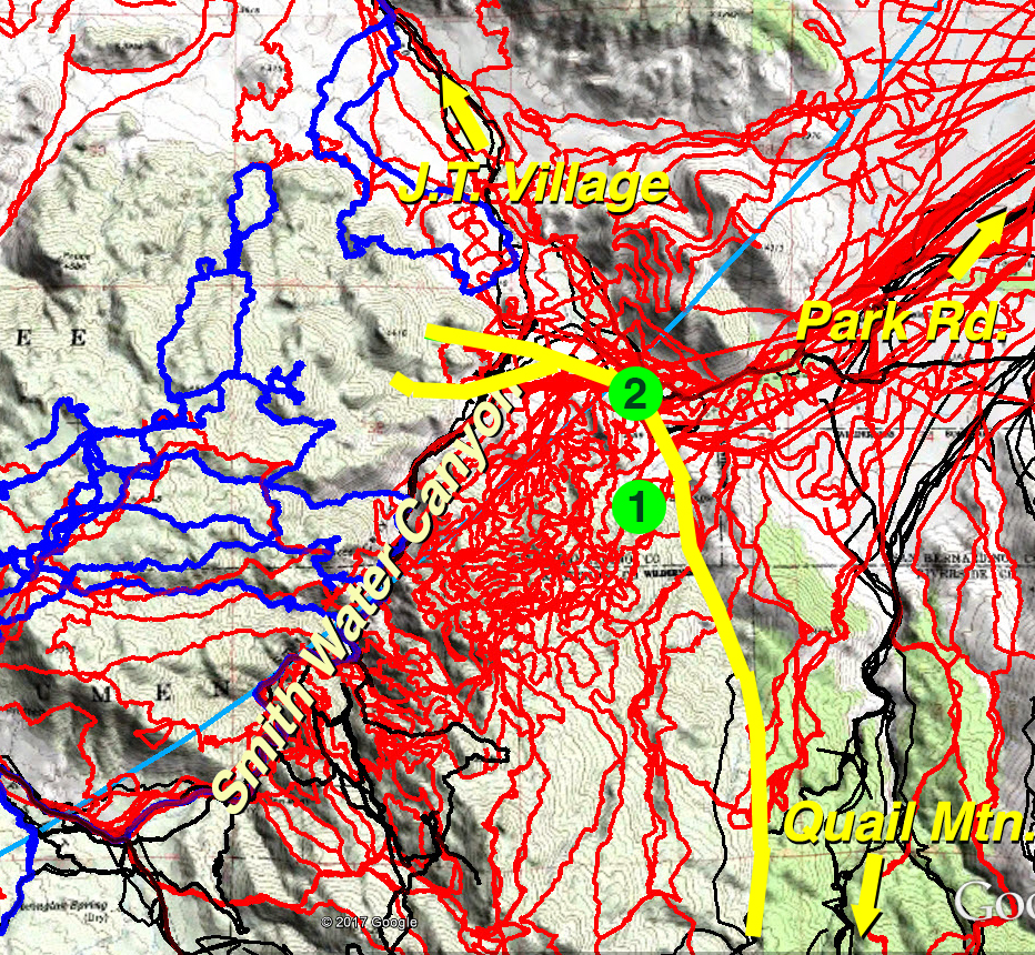
Map of the search tracks in the area Bill may have traveled, pinged the tower, and gone missing. The yellow line is a possible route of travel north from Quail Mountain, splitting into the two most likely paths of travel going up the north/west side of Smith Water. The red lines are search tracks undertaken by Tom Mahood, myself, and other searchers. The blue lines are recent searches of the north side of Smith Water by hiker Bret Lamb. Black lines are from the original search and rescue operation. “1” is the location of Quail Spring, a dry spring that may have been an area Bill was trying to reach. “2” is the probable location of the cell ping.
Bill may or may not have known that it was another 3 to 4 miles to get to help (if he had a map, or was able to get a vantage point while he was near Quail Mountain, he probably had some idea). But he would certainly have been able to see from that spot that there was nothing whatsoever to help him within visual range, and the visual range at that point extends for a mile or two along the easiest routes of travel.
Furthermore, helicopters would have appeared in the air, in the vicinity of Quail Mountain, later that day. Bill may have concluded at that point that he simply did not have the physical strength to crawl the distance that was already visible to him at that point, and that he was unlikely to be spotted from low ground (though given that area is fairly wide and flat, this is a debatable point). He may have decided that his only chance was to climb until his phone gained enough altitude to the ping the tower, and possibly signal a helicopter.
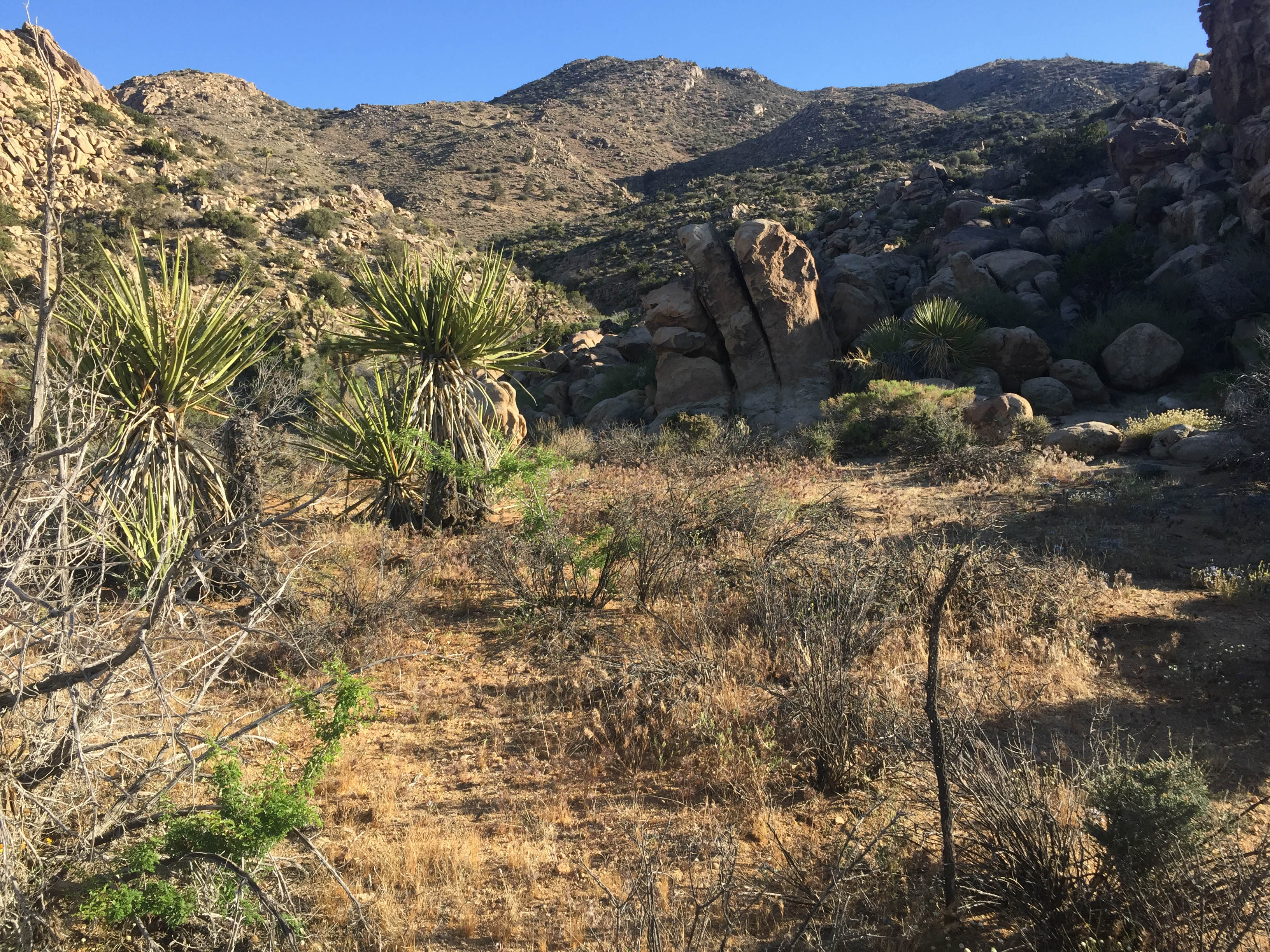
View looking towards the area Bill may have gone after the cell ping, from the back (north) side of the mountains just above the mouth of Smith Water Canyon. The ascent from the other side is steeper than this, but the terrain is similar.
He may also have calculated (correctly) that he would be significantly cooler once he started gaining altitude, and that to stay in the low areas that offered the easiest means of escape also would mean getting fried in the summer sun with only brush for cover – and seeking cover would mean no forward movement. He knew for sure there wasn’t help within a couple of miles in either direction, because he could see it, and he would also be able to see the helicopters were searching in an area far from his location and nowhere he could easily get to.
Bu having just pinged the tower, he might have surmised just a couple hundred feet more altitude would be enough to get a call out. And if it wasn’t, he could just keep climbing until he did. It was a fighting chance vs. what probably seemed like certain failure trying to negotiate, in a weakened condition with another hot summer day dawning, the long stretch of nothing with little cover that he would have seen in all other directions.
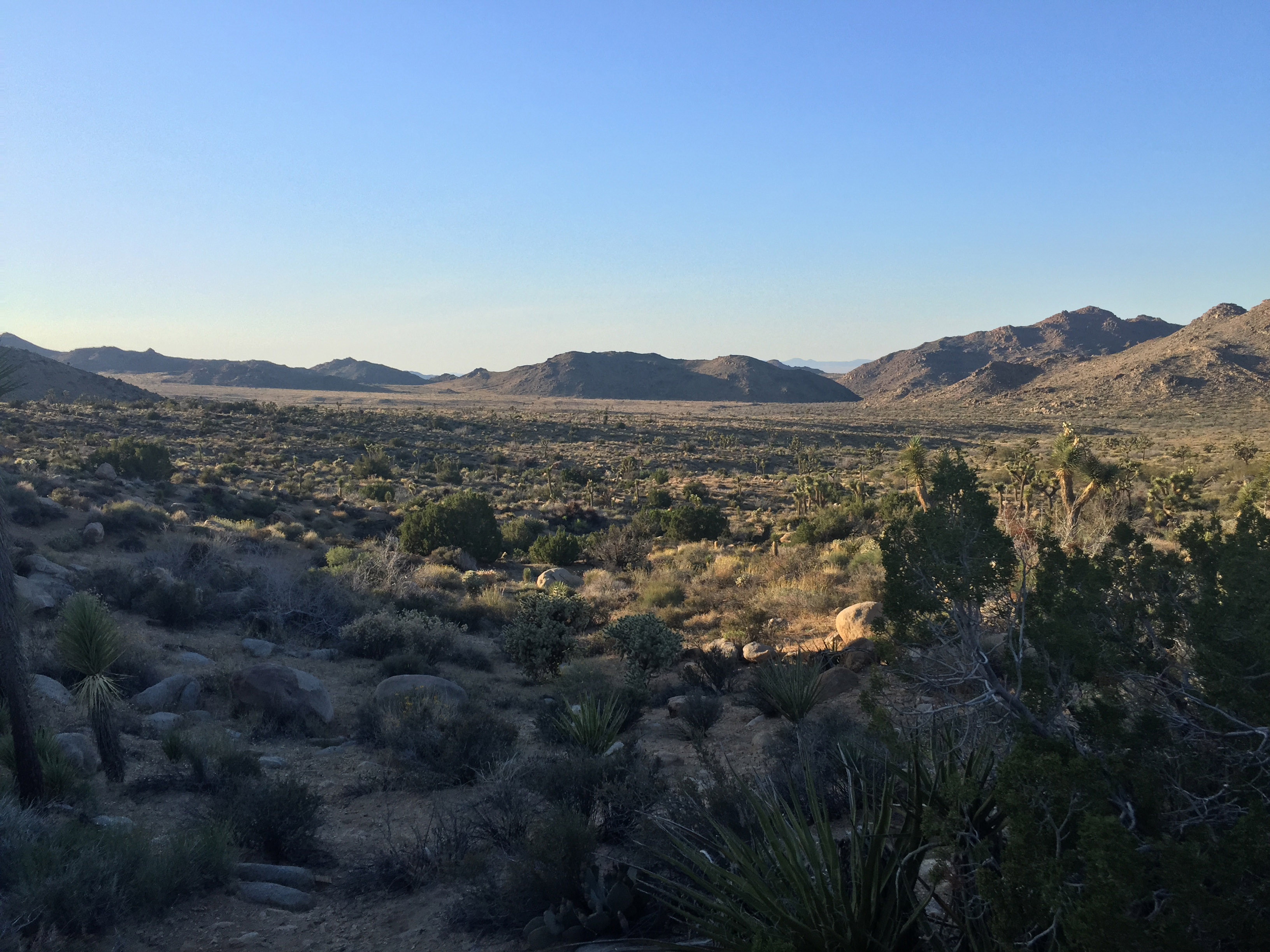
View of the area around Quail Wash north of Smith Water Canyon at sunset. With the shadows reversed, Bill’s view north from the ping spot would have been similar to this.
If this is what happened, it is truly an unfortunate decision, because if Bill had continued north up the wash only half a mile, he would have found more consistent reception in Quail Wash, growing stronger the closer he got to Joshua Tree (This by the way also is an indication that he did not continue in this direction unless his battery did indeed crash Sunday morning, since he would have very quickly been able to call for help otherwise). But given the range of options available to him at that point, with the sun coming up and dwindling physical resources to place bets on, it would have been a logical choice.
Moreover, mounting the north side of Smith Water at this point, though daunting (particularly since, if this scenario is true, he did not make the obvious move back towards Quail Mountain after he was first injured), would have made some sense. As difficult as it was (and unlike the rest of the canyon there are some ways up here that, at least viewed from the lower reaches, are not too bad), the approach to other nearby mountains to the north (which Tom Mahood thoroughly searched, as they do apparently offer some cell reception) was much steeper, and climbing at the mouth of the canyon where the mountain range ended would offer outward exposure on multiple sides.
Unfortunately, though there is cell reception on the north side of Smith Water, it is very, very high above the canyon. Bill might have been able to go on for quite a while making slow progress upward, but it is unfathomable that he could have made the climb that far in his weakened, probably crawling, condition. It would have been a noble and brave effort but one that was doomed to fail.
Can Bill Be Found?
Many have asked the relevant question that after eight years, in the hot desert sun and with scavengers living in the area, would human remains still be findable?
I would argue yes. This is a very remote area that is not often visited. Anything that isn’t part of the landscape sticks out. Human remains might not be immediately noticeable but any collection of belongings – clothes, backpack, empty bottles (none confirmed to be Bill’s were ever found), would immediately draw the eye in that environment. I believe if you got within 10 meters (Tom Mahood opines even further), you’d see that. And then you’d find Bill.
The Conclusion
Sherlock Holmes once said, “once you eliminate the impossible, whatever remains, however impossible, must be the truth.” While the self-disappearance and foul play (assuming it occurred around the private inholding, or conceivably outside the park) theories raise valid questions (WHY move the car?) and seem far fetched on their face, they do fit the facts as far as we know them. But the only concrete evidence that either occurred is the very strange business of the car seemingly being moved. And as has been pointed out in many a missing persons case, eyewitness recollections are often flawed. Maybe it simply just didn’t happen.
If Bill indeed did go missing in Joshua Tree, there are a million unlikely things that could have happened. But strip that all away and we do have these two data points: there is only one place along the 10.6 mile line that makes topographical sense for Bill to be where there is a known ability to connect to Verizon tower – in Quail Wash at the northeastern mouth of Smith Water Canyon. And there is only one place in that entire region that has not been extensively searched: the mountains just northwest of that location.
If Bill is in the park, I think that’s the most likely place to find him.
For a follow-up on this blog, including some feedback and further discussion of these theories, click here.
As always, if you enjoy I Just Disappear, consider subscribing to the blog or making a contribution. Thank you!
Thanks, great read, I hope someone will search that area one day, it sounds logical for Bill to be there.
The good folks at the San Jacinto Hiking Board have been doing great work following up on some of the ideas in this blog (both with searches and critically thinking them) and advancing a lot of ones on their own. I believe one of them did search this area pretty recently. I’m planning to do a follow up blog that incorporates some of the new information and theories pretty soon.
I worked under Bill many yrs ago. Knowing what he was like and the financial problems he got himself into. It would not surprise me that he faked his disappearance
Holly Hayick – As someone who has followed Bill’s disappearance since the beginning, I am fascinated by your comment. Can you elaborate for us? Any details would be much appreciated. Thank you.
Holly, you may have worked with him, but I lived with him for 10+ years and Bill was not depressed or under any pressure. You don’t know what you are taking about. You scenario is not remotely possible.